English
Beta
Hygyrchedd
Hafan
Amdanom
Chwilio
Orielau
Map
Cymorth
Cysylltwch
Cofnod Archif
Canlyniadau
Safle Chwilio Uwch
Nid oes gennych resi chwilio datblygedig. Ychwanegwch un trwy glicio ar y botwm '+ Ychwanegu Rhes'
+ Ychwanegu Rhes
Chwilio
Ail Gychwyn
Foeltrigarn;Moel Trigarn;Foel Drygarn Hillfort
Drawings Collection
Drawings Collection
Further Information
Manylion
Hierarchaeth
Safleoedd Cysylltiedig
Rhif Archif
6031509
Disgrifiad
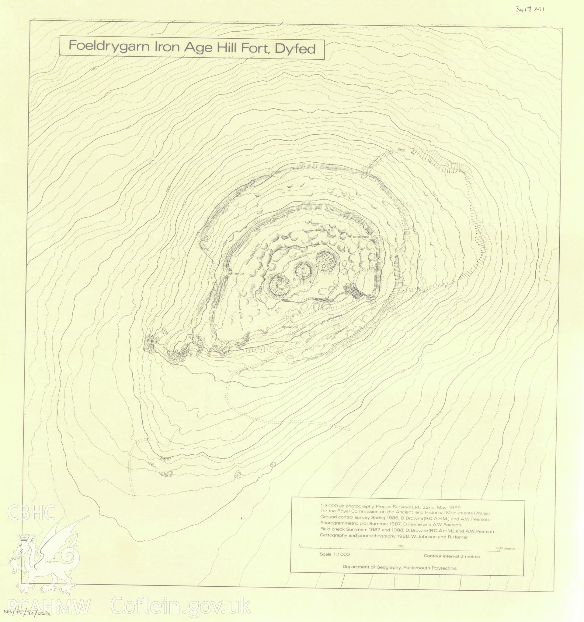
Copy of a measured plan of Foel Drygarn Hillfort made by the Geography Department of Portsmouth Polytechnic, from original aerial surveys by RCAHMW, scale 1:1000.
Cofnod Casglu
Drawings Collection
Cyfrwng
Graphic.
Cychwynnwr
R. Horner, W. Johnson
Dyddiad
1988