English
Beta
Hygyrchedd
Hafan
Amdanom
Chwilio
Orielau
Map
Cymorth
Cysylltwch
Cofnod Archif
Canlyniadau
Safle Chwilio Uwch
Nid oes gennych resi chwilio datblygedig. Ychwanegwch un trwy glicio ar y botwm '+ Ychwanegu Rhes'
+ Ychwanegu Rhes
Chwilio
Ail Gychwyn
Llanfyllin
Ordnance Survey Provisional Edition 6' County Series Maps
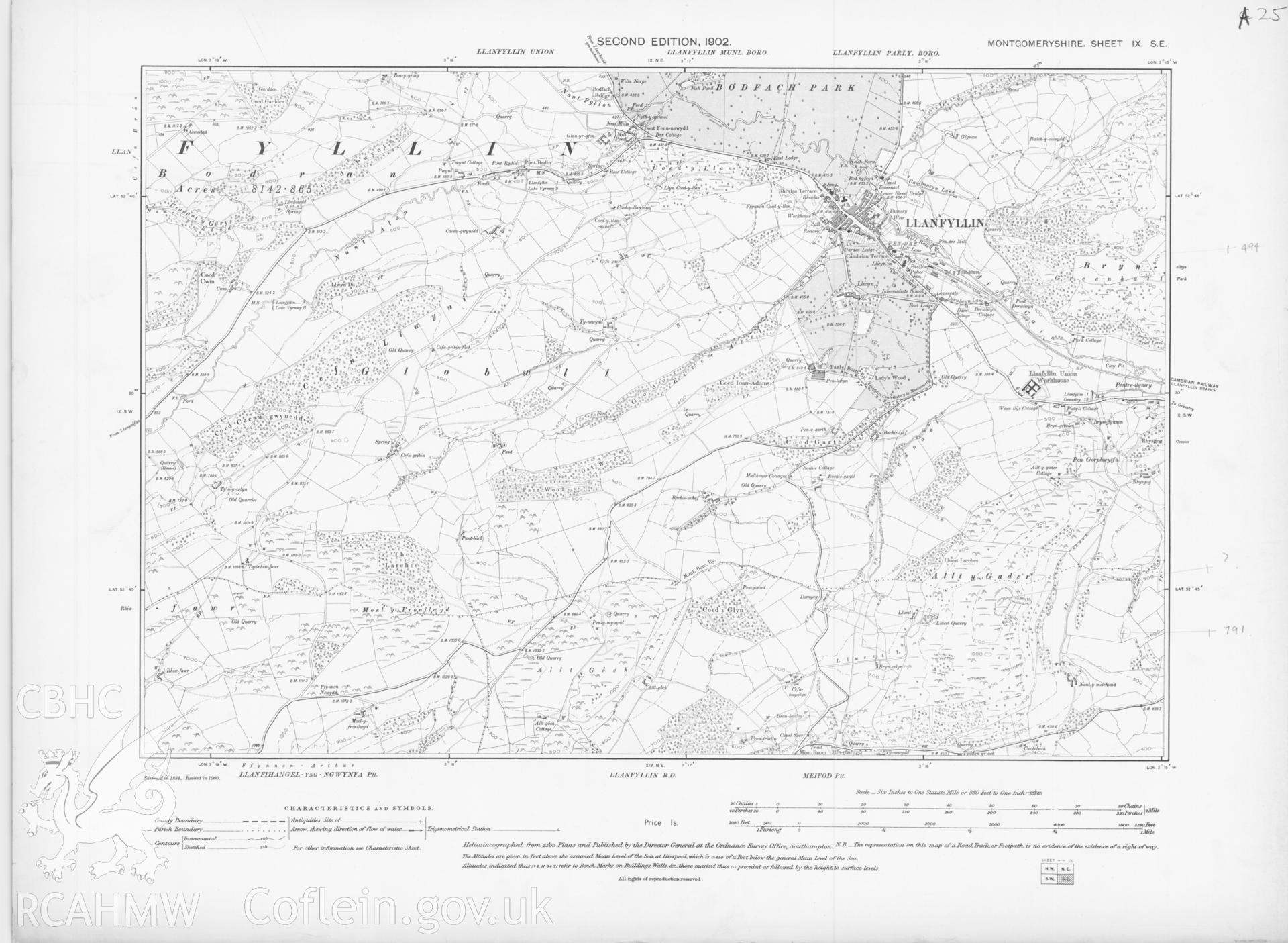
MY.IX.SE - Ordnance Survey 2nd Edition 6' County Series Maps
Further Information
Manylion
Hierarchaeth
Safleoedd Cysylltiedig
Rhif Archif
6210012
Disgrifiad
Digital copy of an Ordnance Survey second edition county series map, six inch, 1:10560, ungridded, showing Llanfyllin area.
Cofnod Casglu
Ordnance Survey Provisional Edition 6' County Series Maps
Cyfrwng
Cartographic.
Cychwynnwr
Ordnance Survey
Dyddiad
c. 1902