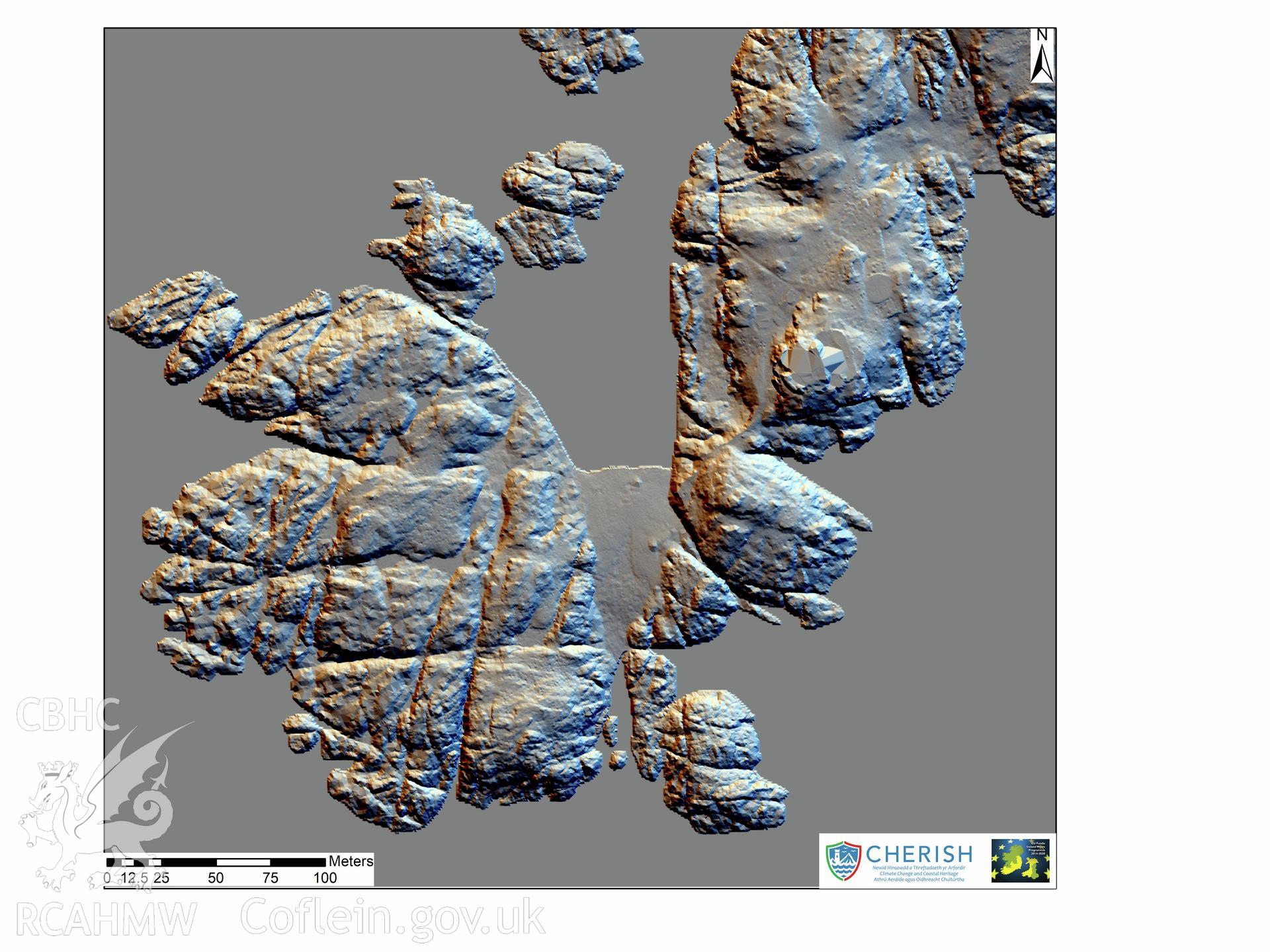
You have no advanced search rows. Add one by clicking the '+ Add Row' button
Ynysoedd y Moelrhoniaid (The Skerries Islet). Airborne laser scanning (LiDAR) commissioned by the CHERISH Project 2017-2021, flown by Bluesky International LTD at low tide on the 24th of February 2017. Southern view showing the ploughed fields. This LiDAR reading shows a digital terrain model (DTM) with hill shading.Further Information
Archive Number
6540677
Description
Ynysoedd y Moelrhoniaid (The Skerries Islet). Airborne laser scanning (LiDAR) commissioned by the CHERISH Project 2017-2021, flown by Bluesky International LTD at low tide on the 24th of February 2017. Southern view showing the ploughed fields. This LiDAR reading shows a digital terrain model (DTM) with hill shading.
Collection Record
CHR - CHERISH Project Archive
Medium
Photo.
Originator
RCAHMW, Bluesky International Ltd
Date
2017