Disgrifiad
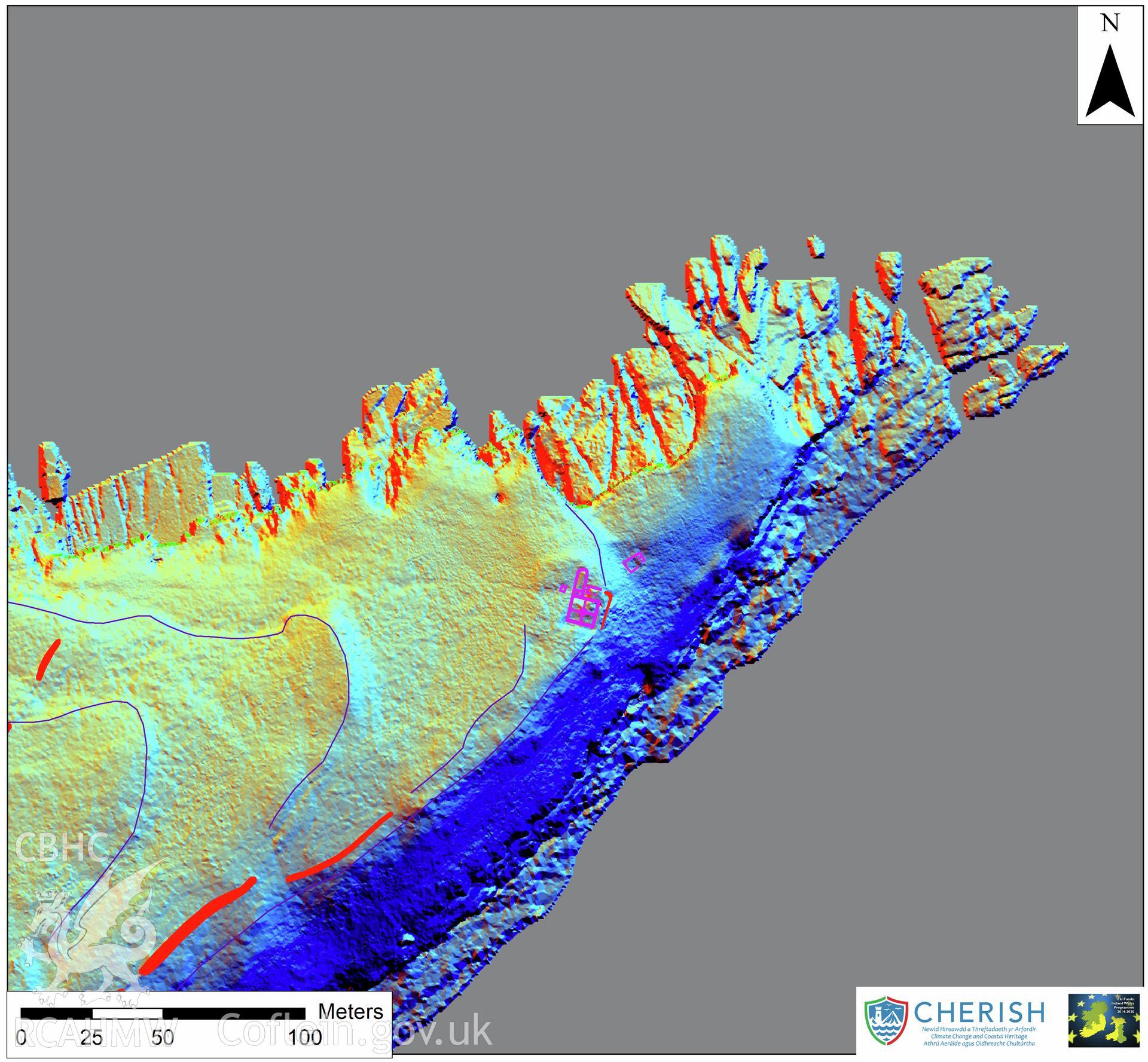
Ynys Seiriol (Puffin Island). Airborne laser scanning (LiDAR) commissioned by the CHERISH Project 2017-2021, flown by Bluesky International LTD at low tide on 24th February 2017. Digital Terrain Model (DTM) showing North part of the island with multi hill shading and aerial mapping highlighting the telegraph station.