Disgrifiad
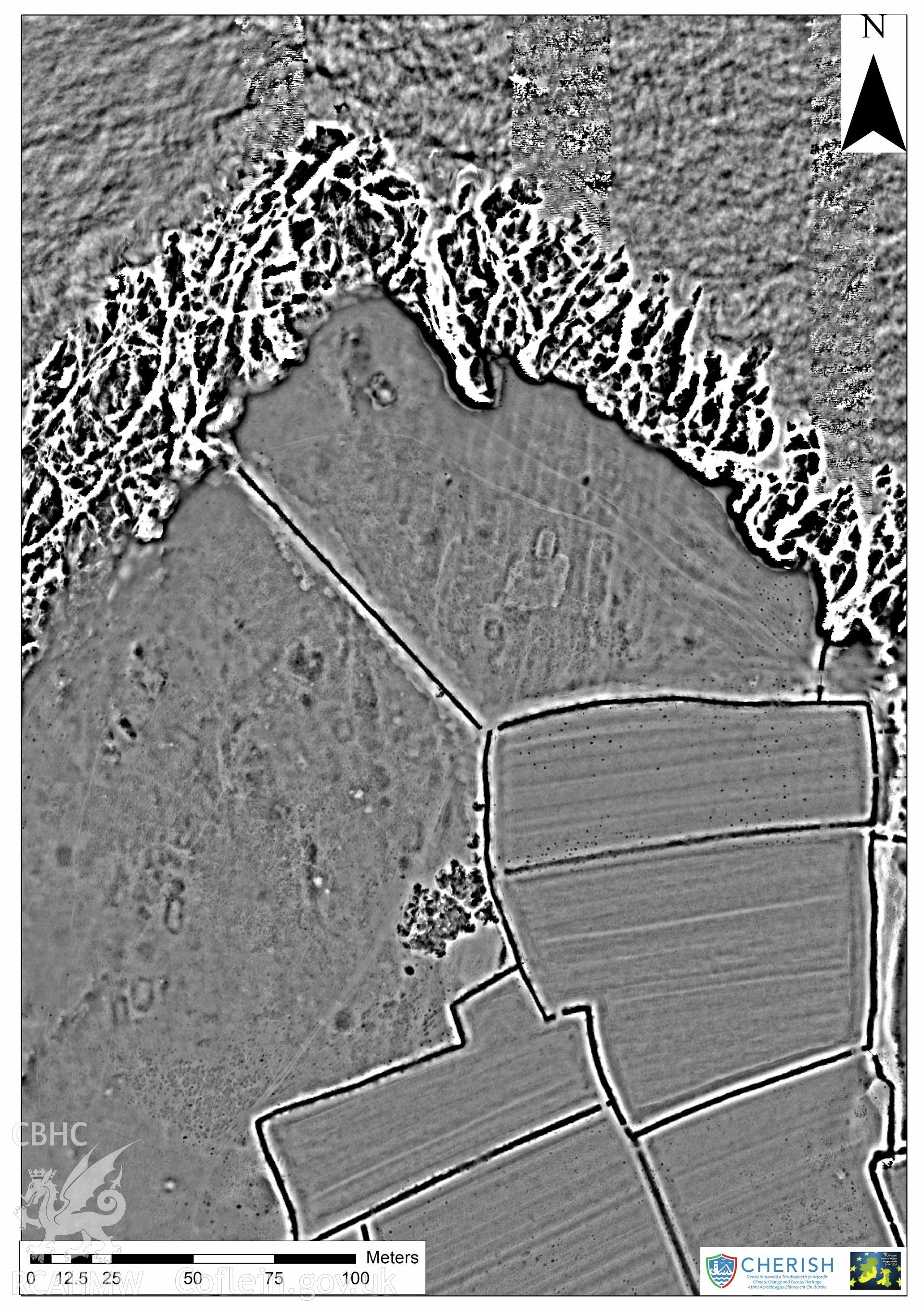
Ynys Enlli (Bardsey Island). Airborne laser scanning (LiDAR) commissioned by the CHERISH Project 2017-2021, flown by Bluesky International LTD at low tide on 24th February 2017. Digital Surface Model (DSM) showing the north part of the island and the Bae
Cofnod Casglu
CHR - CHERISH Project Archive
Cychwynnwr
Bluesky International Ltd, RCAHMW