English
Beta
Hygyrchedd
Hafan
Amdanom
Chwilio
Orielau
Map
Cymorth
Cysylltwch
Cofnod Archif
Canlyniadau
Safle Chwilio Uwch
Nid oes gennych resi chwilio datblygedig. Ychwanegwch un trwy glicio ar y botwm '+ Ychwanegu Rhes'
+ Ychwanegu Rhes
Chwilio
Ail Gychwyn
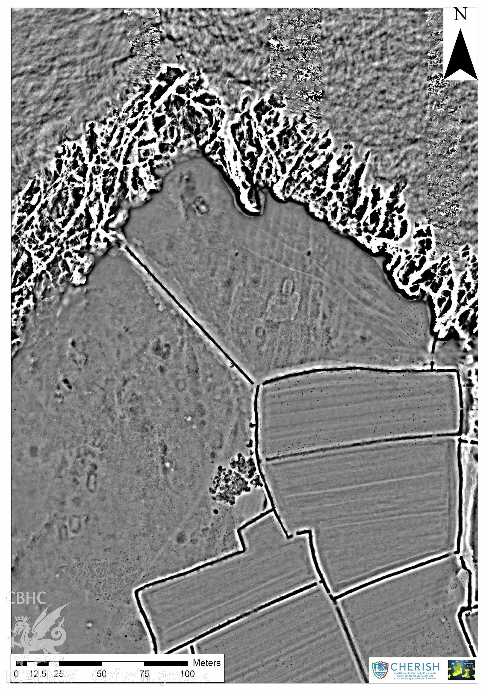
Bae y Rhigol, Rectangular Platform and Enclosure Southwest of, Bardsey Island
CHR - CHERISH Project Archive
CHR_04 - CHERISH Project Archive
CHR_04_04 - CHERISH Project Archive
CHR_04_04_03 - CHERISH Project Archive
CHR_04_04_03_07 - CHERISH Project Archive
Further Information
Manylion
Hierarchaeth
Safleoedd Cysylltiedig
NPRN
Teitl
Math O Safle
Casgliadau
Delweddau
NPRN
15044
Teitl
Bae y Rhigol, Rectangular Platform and Enclosure Southwest of, Bardsey Island
Math O Safle
TŶ HIR
Casgliadau
8
Delweddau
1
NPRN
402783
Teitl
Bardsey Island;Ynys Enlli
Math O Safle
YNYS
Casgliadau
96
Delweddau
74